Cycle Rides from 2021
Great cycling tours, routes, cafés and anecdotes
Lunch at the Lobster Pot, Blackness
Saturday 18th September
We met at Roseburn Bridge and took the cycle path to Cramond Brig. There were eight of us. Three people had electric bikes which generated discussion of the various makes available, the levels of pedal-assist, etc. We took NCN1 to the gates of Dalmeny House, went left through Dalmeny village, past the railway station, to join NCN76, and were soon at the entrance of Hopetoun Estate. Through the two kissing gates, we headed for Abercorn Church and along the coast to Blackness, arriving just before 1 pm.
There were lots of cyclists there so we were glad we had booked lunch in advance. We were all pleased with the menu and the pub. Amazing décor - with the lobster theme.
 We set off south via Cauldcoats Holdings and left onto A904. As the Pardovan road was under repair, we continued east taking the fork to Duntarvie. Great views of the Queensferry Crossing. Passing Totleywells Cottages, we entered the Dundas Estate at the white gate. At the boat house, we stopped for a photo and to admire the loch and trees. Leaving the estate, we turned left onto B800 and right for Carlowrie Cottages. continuing to Cramond Brig. Some people went home via Barnton and others via Cammo.
We were pleased with our ride and lunch. Two people had not taken the coast road before and three did not know Dundas Estate. The weather had been kind, giving us good views all day. 37 miles total.
Barbara
Dumfries and Galloway Weekend
Sat 4th - Tues 7th September
There were eight of us at Maybole Station that Saturday (Harry, Elaine, Jan, Sheelagh, Barbara, Anna, Janet and Bill). Maybole is not the easiest place to get to by train from Edinburgh for 10.30 in the morning! The route was clearly marked from the station (NCN Route 7) so we set off confidently. Too much chatting though, we missed a left turn after two miles and by the time I realised this we were quite strung out, and too far on to turn back. Elaine, Sheelagh and I went via the River Stinchar and the others on the B741, both missing out Crosshill.
 Providentially we all met up again at the bottom of the big hill (Nick of the Balloch, 390 metres) so we all did that together. I think everyone walked up at some point. The sun came out after the climb and we had a long descent over 20 miles via Glen Trool to get to Newton Stewart. There were lovely views over Glen Trool Forest as we swept down the hill, then on beside the River Cree and the ancient oak trees of The Wood of Cree. In the old BikeBus days we used to stay at Minigaff Youth Hostel but that was shut for renovation so we were at The Bruce Hotel in Newton Stewart. I think that everyone was quite pleased not to have to cook though, and we all felt quite Covid safe. The bedrooms were quite spacious. The food was very traditional – not unexpected given the tartan and thistle decor.
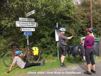 Next day NCN Route 7 was on a mixture of forest paths (with a hellish short hill) and an old railway line to Creetown on the Cree Estuary. After that it was an easy climb on a very quiet road, then a lovely descent with views of more ancient woods (Carstramon Wood) to Gatehouse of Fleet. Lunch was at an old converted mill which now serves as a restaurant combined with a bookshop and craft area. After that we continued south though the grounds of Cally Palace to Sandgreen then on to Borgue. We thought of Tiana as we picked blackberries!
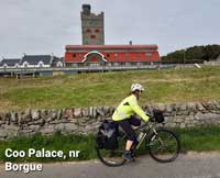 There were sea views over Wigtown Bay towards the Mull of Galloway and we passed the Coo Palace, which was quixotically built for cattle but is now a luxury timeshare. After that it was more sea views over Fleet Bay before we arrived at Kirkcudbright. We stayed at the Arden House Hotel which is slightly out of town. Kirkcudbright is pretty with colour washed buildings and a fishing harbour. Our hotel was fine this time too, a bit more upmarket and with excellent food. The main mystery was why the majority amongst us, who ordered pensioner's portions, actually got bigger helpings than everyone else! Maybe it was because we were cyclists? Nine pounds for three courses too!
 On day three we went north to Tongland Power Station then on a minor road south of the River Dee to Castle Douglas - a climb at first then it was quite easy, a mixture of cattle fields and woodland. At Castle Douglas we had coffee at Designs Cafe, sitting in the garden. At this point the group split into two. The train travellers continued east via Kirkpatrick Durham and the hillside statues of Glenkiln to Dumfries. The car drivers had to collect their cars so had to go north again via Loch Ken and New Galloway to Maybole. This required an extra cycling day which included a long stretch on the busy A713. Fortunately we managed to avoid this by prevailing on a friendly bus driver to take us, with our three bikes, on to Dalmellington. Just before Maybole we cycled through Crosshill which we missed on the way out.
I was pleased to get a text message from Barbara saying the others had got the train safely. I was quite nervous about organising this weekend in the current situation with Covid-19 and it became clear that some members of the group were a bit nervous about coming on it. However it all went very well, it was dry, often sunny, with very little wind and we all had a great time.
Harry Henniker
Photos: Harry, Elaine
and Sheelagh
Vale of Leven to Stirling
Sat 14th August 2021
 The trip was a repeat of Alastair’s popular ride he lead in both April 2017 and 2019, both of which I unfortunately missed. So I’ve not included too many details of the route here other than to say I inadvertently added an extra hill at Balfron. Also, to minimise time on the A811 after Gargunnock, towards the end of the ride, we took the B8075 further north, turned off onto Rossburn Lane and came into Stirling along Drip Road.
The ride started from Dalreoch station but not knowing how many would get their bikes on each train, or the weather on the day, we arranged to ride the first 6 miles along the banks of River Leven to Balloch in groups and meet at Corries café. In fact the weather was fine and with good bike space on trains we formed just 2 groups for this first short section.
 Alastair was delighted to find apple pie available at Corries although it wasn’t specifically on the menu and luckily got the last piece.
There were other temptations on the way – an honesty box outside a cottage at Gartness with ice-cream and drinks. Also, the café at Killearn Village Hall offering fantastic views over the countryside towards the Highlands. Another time.
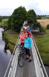
Jo was chief photographer for the day – amazing us all with her dare-devil athleticism on the pipe bridge over Endrick Water to get an aerial shot of us all. The open view from the bridge takes in the impressive Dalnair Castle.
Our lunch stop was at Doyle’s, Balfron, where, as with Corries, a large table had been set for us. The bread at Doyle’s is baked fresh each morning - delicious. The view from the terrace is amazing – looking down the hill across the Endrick Valley to the Campsie Hills.
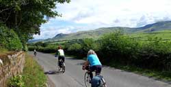 There were dramatic hilly views the whole day – from the Kilpatrick Hills to the foothills of the Scottish Highlands, the Campsie, Fintry and Gargunnock Hills. Despite roaming grey clouds at times we rode a dry path taking in the views as we followed largely quiet roads including a gated minor road, a section of a military road and a gravel track through the Leckie Estate.
Our last stop was at Gargunnock Inn where we sat outside with pots of tea, or beers for the more daring. It was Jo’s first Mellow Velo ride and she was suitably impressed with the number of refreshment stops we managed.
 Sian discovered a slow puncture after lunch which seemed to hold relatively well with the occasional top up of air. But the journey back on the train proved too much and she ended up walking home from the station.
We reached Stirling station (42 miles) not long before an Edinburgh train was due so there was a rush for tickets, then to get everyone up in one lift and down in the other to the right platform. Having accomplished that timeously the train was delayed. On arrival all 6 for Edinburgh managed to board leaving John to await a Glasgow train.
Alastair, Anna, Jenny, Jo, John, Sian, Tiana
Text: Anna; Photos: Jo
North Pennines
Sat 31st July - Sun 1st August 2021
This ride was notable for the long interval between when it was proposed (30 November 2019) and when it was carried out. In the Mellow Velo programme circulated early in 2020, the ride was scheduled for 1st and 2nd Aug 2020, with accommodation at Alston youth hostel. Sadly, coronavirus arrived in the UK before that date and, in May 2020, we reluctantly decided it was simplest to postpone it until the equivalent dates in 2021, when it took place on Sat 31st and Sun 1st Aug. There were six of us in the group.
In 2019, we had conquered Hartside Height, which is over 1900ft ASL, but is not the highest road in England. In 2020-21 the targets were Killhope Moor which, at 2056 feet, is the highest classified (i.e. A or B) road in England; and the Staward Hairpins, which are one of the few sets of properly-engineered alpine-style hairpin-bends in England. Both of these could be included in a circuit beginning north of the Pennines at Hexham, going south, up East Allendale past Allendale town and Allenheads, and over to the head of Weardale, then west over Killhope Moor, and down past Nenthead to finish at Alston on Sat night (30 miles, mostly uphill!). On Sunday, north-east over to West Allendale, and UP the Staward Hairpins. Then we could choose between minor roads near Langley Castle and the Allenbanks estate, leading to a footbridge over the South Tyne near Bardon Mill station. This would make only 20-22 miles for the day, so we might wish to turn west and follow the old road to Haltwhistle (making 25-27 miles), especially as more trains stop at Haltwhistle than at Bardon Mill.
The above route (Plan A) was originally proposed so that we would appreciate the engineering merit of the Staward Hairpins by cycling UP them. This meant that we had to ascend Killhope Moor from the east, which is more likely to have a head wind. Also, the 207m ascent of Killhope Moor would come at the end of the longer of the two days, which began at only 40m above sea level, and would immediately follow the 170m ascent of Burtree Fell.
We also considered Plan B, in which the ascent of Killhope Moor would begin at Alston, which is already 274m above sea level, and would be the first climb of the day, and is more likely to have a following wind. We can also compare Plans A and B in terms of distance in miles and total ascent in metres, as follows.
| Distance in miles | Total ascent in metres | |||||
| Saturday | Sunday | Total | Saturday | Sunday | Total | |
| Plan A | 29.4 | 27.5 | 56.9 | 807 | 298 | 1105 |
| Plan B | 22.9 | 34.7 | 57.6 | 579 | 553 | 1132 |
Thus, in Plan A the distances on Sat and Sun are quite similar, but the ascents are very different, whereas in Plan B the ascents are almost the same on the two days, but the distances are quite different!
Other things being equal, Plan B was preferrable, but weather might make Plan A the better choice e.g. if Saturday’s weather was going to be much better than Sunday’s, or if a strong east wind was forecast for both days. With Plan B, there would be time for everyone to have ‘second breakfast’ in Hexham. With Plan A, we would need to eat ‘second breakfast’ on the train, so that by 1054 we would be ready to start cycling. In fact, on Friday afternoon, the forecast was for dry weather with strong westerly winds on both days, so the decision which I emailed to everyone was Plan B.
As we would be arriving at Hexham on different trains, I proposed that we assemble in the nearest café to the station. A recent website indicated that this was a Costa restaurant, and showed its exact location on a street plan. I included instructions on how to get there in my decision Email. When we arrived, it was not there, but enquiries revealed that it was really about 300 yds away in a shopping mall! We had to Email the others to tell them this!
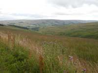
 From Hexham station (alt 40m), we headed through the town centre, passing Hexham Abbey, then west on B6305, climbing steadily past Low Gate, to a height of 300m, and continued straight ahead on B6305 until it met A686 near the Carts Bog Inn. We then followed the A686 nearly all the way to Alston. This began with the descent of the three Staward Hairpins from 250 to 149m. The photo shows the third and last hairpin. We knew that the Whitfield Village Pantry might be open on Saturdays from 9 to 2, but had not been able to confirm this because its phone only accepted calls from people it recognised! Hence, we were pleased to find it was in fact open all afternoon, and we enjoyed lunch at tables in their garden.
 From Whitfield (182m) the road rises gradually along the West Allen valley to 238m, then more steeply to 471m on Willyshaw Rigg, where we paused to admire the view. The A686 then descends gradually to Alston (274m), which would have made a total of only 23miles for the day. Consequently, most people chose to leave the A686 at the junction of the B6294 (370m) and follow it along the contours to Nenthall (367m), then descend to Alston by the A689, adding about 5 miles, and providing a downhill introduction to Alston’s precipitous High Street.
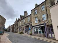 We stayed overnight at Alston youth hostel, with some anxiety about possible infection by COVID. When I had confirmed our booking for 2021, the hostel was subject to strict rules to avoid infection. For example: only 2 groups in the hostel at a time, members kitchen out of bounds, showers and toilets assigned to groups. The English government relaxed these rules a couple of weeks before our visit, but I was pleased to receive a letter from the Manageress before we arrived, asking us to continue to observe most of these rules even though they were no longer legal requirements. I think everyone was happy not to ‘self-cook’, but to have our evening meal at the Cumberland Inn, and to take the breakfast provided by the hostel.
 On Sunday, from Alston hostel at 274m, we cycled or, in most cases, walked up the High Street then followed A689 to climb steadily to Nenthall (367m) and Nenthead (450m). My companions were tolerant of my reminiscences of when I lived here for 6 months when I was 5 years old.
Above Nenthead, the ascent of Killhope Moor began in earnest. Unlike the A686, the A689 is not engineered to avoid severe gradients, but makes a series of sudden upward leaps, marked by warning signs, with gentler slopes between. First, we met a 15% slope (1 in 6.7), then a couple of 18% (1 in 5.6) then, last but not least, 19% (I in 5.3). Half of the group, including myself, walked the steep bits, but the others managed to cycle all the way up!
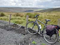 Finally, at the top of Killhope Moor (627m, or 2056 feet above sea level, or 353m above the hostel), we paused for a group photograph and to admire the view . I was glad we had not chosen Plan A, because the slope on the Weardale side had similar maximum slopes, but was not broken by any gentler sections.
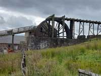 We soon reached the Lead Mining Museum which has been established in Upper Weardale since I last passed this way, close to the lead mining water wheel. The museum has a café, which had only recently re-opened after the Lockdown. We were able to eat lunch here, sitting at tables outside.
 We continued down Upper Weardale as far as Cowshill (420m) then made a sharp left turn onto the B6295. This is a steep climb onto the top of Burtree Fell (570m), but better-graded than the A689, with no slopes steeper than 1 in 7. From here the B6295 descends steeply to Allenheads (400m), and then more gradually down East Allendale to reach Allendale Town (250m).
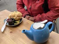 Here we stopped for tea at tables outside the Forge Café in Market Square. Cyclists often order scones at tea time, but I usually find they are not quite enough e.g. the ‘dainty scones’ once encountered by Mellow Velo at the Gargunnock Inn. Sometimes I wonder if I should order 2 scones. But the Forge Café produced the largest scone I had ever met – about 4 times the usual size, or 8 times the size of the Gargunnock scones.
From Allendale Town we climbed gently northwards on B6295, which reaches 300m, then descends through the crossroads where it crosses B6305, which was our route on the previous day, and ends at a T-junction with A686. Here we turned left, and immediately right. This took us onto a quiet and fairly flat lane, but sadly we then had to descend from 190m on the plateau to 90m on the flood plain of the River South Tyne, by a slope exceeding 1 in 7, with blind bends. Thus, we had to waste much of our hard-earned potential energy by converting it to heat in the rims of our wheels by braking, instead of into kinetic energy by freewheeling.
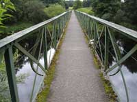 This road took us to the bridge over the combined River Allen, and past the Allenbanks Country Park. We then chose to stay on the south side of the South Tyne, following a delightful road through the tiny hamlet of Beltingham, leading to a cyclable footbridge over the South Tyne at Bardon Mill. Here we turned west and followed the road through Melkridge which used to be the A69, before it was replaced, but is now signposted as NCN72. At the beginning of Haltwhistle, we left the Sustrans route to take one of the two (!) new southern by-passes of Haltwhistle, which led directly to the station, where Plan B terminated, making about 35 miles for the day.
Those who had to catch a train from Haltwhistle to Carlisle had been anxious about reaching the station in time, but in fact everyone did, and moreover there was space for them on the trains they hoped to take. Nevertheless, I have to admit that this was the weakest link in the plan for the weekend: using a train service on which cycle spaces are not reservable in order to catch a specific train on which one has booked a cycle space is not advisable. In this case it was unavoidable: the alternative would have been to cycle all the way to Carlisle or to Newcastle! My original advice was to reserve a cycle space on the 1905 from Carlisle to Edinburgh. That meant that we would have at least 2 and possibly 3 chances to get onto the trains from Haltwhistle to Carlisle. The problem was that the 1905 from Carlisle was an Avanti train and, owing to the Pandemic, Avanti did not confirm the trains it intended to run until a few weeks beforehand. I therefore suggested that people might look at the 1818 or 2017 trains, which are run by Transpennine. Several people therefore reserved places on the 1818 train. I really should have suggested that they looked only at the 2017 train.
In the end, for other reasons, we did not have 6 people all trying to get onto the trains from Haltwhistle to Carlisle. One of us decided to stay with a friend in Newcastle. And I realised, before the Avanti tickets became available, that the Scotrail Sunday strikes would still be in force on 1st August, so that I would not be able to get home from Edinburgh to Linlithgow on Sunday night. I therefore booked a room in Haltwhistle, and on Monday John and I cycled from Haltwhistle, by NCN68 to Lambley, then A689 to Hallbankgate, then by Talkin Tarn (lunch), to Corby, then by NCN72 through Crosby and Linstock, to Carlisle, where we got trains home.
I would like to thank John, Tiana, and Anna for providing a selection of photographs to illustrate this report, from which I have chosen. Last but not least, I thank my cycling friend Oliver, who lives in Hexham, for his local knowledge e.g. about the probability of getting cycles on the Newcastle - Carlisle railcars, about the provision of cycle transport by SUV from Haltwhistle to Carlisle (not available on our dates), about cafes (but not in Hexham!), and for nudging me towards Plan B.
Alastair M.
Photos: Anna, John and Tiana
Yorkshire Wolds
Mon 19th - Fri 23rd July 2021
This ride was based on the 146 mile Yorkshire Wolds Cycle Route (YWCR) and we used a link suggested on the Sustrans map from Kirkham via Stamford Bridge to York, where we arrived by train.
MONDAY
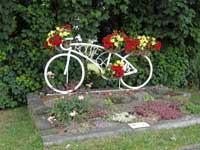
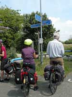 The party assembled at York station and we departed around noon. Alec, who arrived earlier, had noticed that Micklegate was closed to motor vehicles so we went that way through the middle of the city and joined the Foss Islands cycle route (NCN658 and 66). Its start was obscured by a shopping centre but the route was well marked afterwards. A sign to Bad Bargain Lane amused us but we did not follow it! The route passed through suburbs and left the city behind, going under the A64 and turning past the Museum of Farming. Unfortunately its café was closed on Mondays so we continued, jiggling around A roads before joining a minor road into Dunnington, where the café was also closed. An attractive sign for NCN66, constructed from a bicycle, directed us on to pleasant farm tracks for the next few miles. The Balloon Tree Café near Stamford Bridge was a short ride alongside the A166 and we stopped for lunch.
 We left NCN66 afterwards and took a route along minor roads suggested on the Sustrans map. The first road was remarkably busy, given that it was not an obvious link between towns, but this was common throughout the trip. Fortunately we turned onto quieter lanes before Buttercrambe. At Bossall we spotted a weathervane in the shape of a dragon on the Church of St Botolph. The next curiosity was the level crossing at Howsham. The railway line from York to Scarborough still has jointed track and manual signals, so the level crossing has a signal box and a gate that is opened and closed by hand. The signalman was a jolly soul with a broad Yorkshire accent, who offered to refill our water bottles. We crossed the railway again at Kirkham Abbey, which had fancier gates that could be operated from within the signal box.
 We stopped to look around Kirkham Priory, in a lovely location by the River Derwent (but without a café, which would have been welcome). This was followed by a short climb into Kirkham, where we joined the Yorkshire Wolds Cycle Route (YWCR) on one of its steeper sections. A pleasant ride through rolling countryside, with good views across the valley to the Howardian Hills, led into the outskirts of Norton-on-Derwent. A bridleway avoided the suburbs, and looked in reasonable condition, so we started along it. Inevitably it became narrower and rougher going; perhaps not a good choice. A few more uneventful miles brought us to the delightfully named Ham and Cheese pub in Scagglethorpe. We had been advised to book a table in the restaurant because today was so-called Freedom Day (from Covid) in England, but luckily they were not overwhelmed with diners. About 30 miles.
TUESDAY
 The day dawned with a cloudless sky, which continued throughout – a scorcher. We rejoined the YWCR in the pretty hamlet of Settrington and tackled the most punishing climb of the route. The reward was a glorious view of the big skies from the top of the wold. A few more miles, in and out of the dales, brought the further reward of coffee at Sledmere House. This also had a shop so we stocked up for a picnic lunch. A curious memorial nearby recalls the Waggoner’s Reserve, a unit of expert horsemen who served in WWI.
 A few miles of undulating terrain brought us into the valley of the Gypsey Race. The Wolds are chalk hills, so most of the valleys are dry except after heavy rainfall, but the Gypsey Race is a permanent stream and we followed it for much of the day. The villages had a sequence of information points and we started in Helperthorpe, where we looked around the church. Many of these buildings are Victorian, funded by Sir Tatton Sykes of Sledmere and designed by the architect G. E. Street. Helperthorpe was one of the few ‘Thankful Villages’ in WWI, meaning that no servicemen lost their lives.
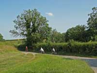 The route continued through Weaverthorpe and Butterwick before turning out of the valley at Foxholes. We had not passed any cafés so we ate our picnic on a grassy spot, out of the sun. This set us up for the climb on to the most northerly wold and our first descent through a dale. These have an unusual profile: the floor is nearly flat, with a gentle slope that makes for an exhilirating freewheel, while the sides climb steeply up from the floor to the surrounding wold. This might seem an unlikely place to find a brewery but we passed Wold Top at Hunmanby Grange. A drink would have been refreshing in the heat but unfortunately it was closed.
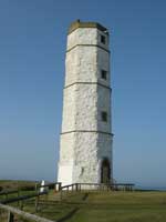 We decided to omit Hunmanby and took a short cut across the YWCR to Burton Fleming. The 2011 Sustrans map shows a pub and café in the village but neither still operates so again we found a shady patch to sit on the grass. We resumed the YWCR in Grindale and followed it to Bempton. Here we had the choice of visiting the RSPB reserve at Bempton Cliffs or diverting to Flamborough Head. We went for the latter and got a splendid view of the cliffs and lighthouses in the afternoon sunshine. The earlier lighthouse was built from chalk, some distance inland, and was a private venture that proved unsuccessful. The newer structure is more conventional. A few more miles and we arrived at our hotel in Bridlington. 49 miles.
By now we were running late and the hotel had stopped serving dinner by the time that we had showered. Instead, we wandered to the harbour, where we had been recommended a pub with good fish and chips. Thwarted! – it was closed, and so was almost every other restaurant. Even Wetherspoons was not offering food that evening. Eventually we found an Indian restaurant and ate a belated curry. Darkness fell much earlier than we expected because we were both south and east of our homes – 25 minutes before Milngavie, where John lives.
WEDNESDAY
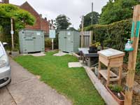 The route out of Bridlington passed the Priory, an impressive church with a separate, fortified Baylegate whose museum was closed. The road climbed gently as it went inland. John had found this road to be unpleasantly busy on the recce but it was not bad today. We diverted from the YWCR and dropped down to Rudston, where we encountered the Village Store. This was not a conventional shop but two outdoor wooden cabinets with an honesty box, from which Alec bought a bottle of water.
 The main attraction in the village is the tallest megalith (7.6 m) in the UK, which stands in the churchyard. We also found the grave of Winifred Holtby, whose novel South Riding is set around Hull, and the burying place of Macdonald of the Isles. After looking around the church we rode back over the wold and descended to Burton Agnes Hall. Most visitors must pay to enter the grounds but cyclists who patronise the café are allowed in free – good for them!
We took a short cut on the next section of the YWCR to avoid Driffield and its busy roads. A Network Rail van was parked at a level crossing and the occupant kindly opened the wicket gate for us to cross. He explained that he was checking the (jointed) tracks for buckling; their temperature had reached 47°C in the sun yesterday, although it was less hot today. St John’s Well was a curious, beehive-shaped structure next to a lane, protected by iron railings that looked unnecessarily secure. At Wansford we crossed the Driffield Navigation (canal) at a lock, which looked in good condition but did not appear to be well used. Lunch was at the Stove Café Bistro, Hutton Cranswick Garden Centre, where we arrived only a few minutes before they stopped serving food.
 We were now dropping down to a plain and should have been able to see Beverley but the air was too hazy. The tall spire of St Mary’s Church, South Dalton, soon came into view and we arrived after pedalling a few miles. This is another huge Victorian church, which seems out of scale for the tiny hamlets around it. It houses a monument to Sir John Hotham with a conventional carving on top of him as a knight and, underneath, as a skeleton.
 A few more miles took us to Cherry Burton, the third ‘Burton’ village of the ride. Even the B roads are busy in this part of the world so we were grateful for the cycle track alongside the road into Beverley and we navigated into the centre without difficulty. Locating our accommodation proved a different matter! Eventually we spotted a narrow alley that led to the Windmill Inn. Fitting our five bicycles into a shed was a challenge most nights and this was the tightest fit of all. 39 miles.
We had planned to eat in the inn but, like so many places, it was not serving food and we had to go out. We were much earlier than the day before but again found few places open. Luckily a restaurant was available nearby, although service was slow. We wandered to the Minster afterwards as a nearly full moon rose and were startled by the screeching calls of some birds flying overhead. Tiana identified them with the aid of the RSPB website as peregrine falcons, and they are probably nesting in the Minster tower.
THURSDAY
 After the usual, leisurely breakfast we returned to the Minster, stocking up on the way with snacks for elevenses. We noticed that the phone boxes are cream rather than red because the town was formerly served by Hull Corporation Telephones rather than the GPO. The weather was set to be another scorcher. Unfortunately the Minster was closed so we wandered around the outside and located the Friary, a YHA hostel where we would have stayed under normal circumstances.
The route out of Beverley led to the B1230, where we encountered an unusual problem – a cattle jam! The road runs through a common with a herd of grazing cattle, who wandered across the road without regard to the traffic. A lorry driver tried to shoo them away but they ambled back as soon as he jumped in his cab. We helped to clear the way for him before cycling on. In Walkington we left the main road and climbed gradually back into the wolds. In clear weather we would have been able to see York in the distance, but not today. North Newbald had no refreshments (the unusually named Gnu Inn was closed) so we climbed again and turned on to the only roughstuff on the official route. Near the top we found a shady spot to rest and eat our snacks.
 We finished the track and were rewarded with a long freewheel before entering another dale. After riding along the floor we had to climb the steep side to reach the lunch stop at the Fiddle Drill café, Goodmanham. The outside seating was exposed to the sun but we were lucky and got the last table inside. The route then cut across the edge of the hills before ascending back into the wolds again. The road from Londesborough to Burnby had been beautifully resurfaced to a remarkably high standard for a country lane, which puzzled us, but a stream of heavy lorries soon showed why. Symbols of fictional detectives, ranging from Sherlock Holmes to Kojak, adorned the wall of a house near Burnby and we admired some multi-coloured brickwork on houses in Pocklington. It was not clear whether the café at Kilnwick Percy Hall Buddhist Centre was open so we carried on to the Ramblers’ Rest café in Millington, where we arrived (yet again) a few minutes before closing time.
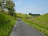 The YWCR takes a remarkably convoluted way from here to Thixendale, probably to incorporate some lovely scenery. The dale from Millington to Huggate was beautiful, perhaps the most attractive of the whole ride. We then had to zigzag around roads on the plateau before taking the lane that descends into Thixendale. The dale is so narrow that the village was invisible until the final bend in the road. Even then we could not see the Cross Keys pub, which was down a side turning and did not have a prominent sign. (Apparently a symbol with crossed keys was used to indicate an inn on old maps, hence the popularity of the name.) 43 miles.
Our accommodation was in a building next to the pub itself. The bedrooms were small but each had a cosy nook with armchairs and table with kettle. We ate in the pub, looked after by the friendly landlord and landlady; there was nowhere else in the village or for miles around!
FRIDAY
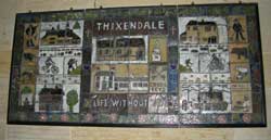 We wandered around Thixendale before leaving. Again the church was the main point of interest and a sound and light tour explained that the building is another Victorian structure due to Street and Sykes. The parish is one of six that make up the “Waggoners’ Benefice”. A panel depicted “Life without TV” because the village was one of the last places in the UK to get an acceptable signal. The building next to the church is now the village hall but had been built as the school and was a YHA hostel from 1970–1999.
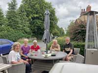 The ride began with the gradual ascent of Waterdale, one of several dales that converge on Thixendale. The verges were particularly attractive with scabious, bellflowers and other plants. Anna noticed some objects that looked more brown than green, which she realised were two pairs of very long ears. They belonged to two hares – nonchalantly pretending that they weren’t there by sitting still. From the top we could see across the Derwent valley to the North Yorkshire Moors. The road dropped steeply into Leavening and undulated as we made our way to the edge of the wolds. Some of the lanes were delightfully rural, with thick grass growing down the middle. After 8 miles we reached Westow, where the door of the Blacksmiths Arms was open. They needed no persuasion to turn on the coffee machine so we enjoyed an early elevenses. Another mile took us to Kirkham and we had completed the circuit of the YWCR (apart from the sections that we omitted, of course!).
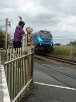 We retraced our route of Monday back to York. The same signalman was on duty at Howsham and we watched him in action as he closed the gate for two trains to pass through, one hauled by a Class 68 locomotive. We waved from the gates like the Railway Children! Lunch was at the Balloon Tree again before we rode into the city and finished our journey in front of the Minster. John departed to catch his train while the others explored the walls until their trains were due. 30 miles.
The trains home were a miserable experience for most of us. John did not reach home until 0030 because of damage to overhead lines around Haymarket and (mostly) misinformation from ScotRail. Anna, Barbara and Tiana should have been on a train together but it did not have enough bike spaces so Anna and Tiana had to wait an hour for another train. Alec was merely delayed. Not much fun, and a disappointing ending to an enjoyable holiday.
◊ ◊ ◊ ◊ ◊
This route was suggested by John’s daughter, who lives in Yorkshire. The Wolds are pleasant and rolling countryside, nowhere near as punishing as the Dales or the Moors, and the route went from moorland grazed by sheep to coastal cliffs. Some of the climbs out of the dales were steep and the roads were often busy, but the worst had cycle tracks along them. Our highest point was around 220 m. The 146 miles of the YWCR had plenty of points of interest, including many Victorian churches, but Beverley Minster was closed while we were there. Flamborough Head was worth the diversion but it was a pity that we had to omit Bempton Cliffs. The weather was warm, dry and mostly sunny, with a variable (and welcome) breeze, and perhaps too hot on Tuesday and Thursday. We got through plenty of sunscreen.This trip was postponed from 2020 because of Covid and was not easy to arrange in 2021 either. It was initially planned as a long weekend but no accommodation was available so we had to move it to Monday–Friday. The only hostel in the area is in Beverley but it was closed so we had to use pubs and hotels instead. The overnight stops were arranged around Thixendale because the five of us filled their bedrooms. Most cafés were open but some areas were deserts so we had to carry snacks and plenty of liquid. It was unexpectedly difficult to find places for dinner in the towns, presumably because of the current shortage of staff in catering businesses. We always had a good choice for breakfast and several of us decided that the best choice was poached egg and mushrooms on toast.
John
Photos: John, Anna and Tiana
Pencaitland Ride
Sat 17th July 2021
On a hot sunny day we enjoyed a leisurely ride and lunch at the excellent Rosearista Coffee Shop just off cycle path at Pencaitland.
It has plenty of seating, indoor, outdoor, and outdoor covered areas.
Despite a slight diversion to start, due to rockfalls in Holyrood Park, and a false and unnecessary “Closed” sign on the Innocent Rail cycle path!, we took the usual route to the River Esk, Whitecraig and Pencaitland Rail path.
After lunch, our group of 8 cycled on to Tranent, Cockenzie and back by the coastal path to Musselburgh.
We cooled down with ice cream at Fisherrow and applied more sun cream!
Thanks to our group of 8 for a sociable ride and lunch on a hot Summer’s day.
Sheelagh
Four Abbeys day ride
Saturday 19th June 2021
We were nine, including some faces (and bikes) I hadn’t seen for a while, covid notwithstanding. Counting at the beginning was quite straight forward – three on one train, three on the next and three meeting us at the Greenhouse Café in Melrose. Two had even gone as far as overnighting in the locality.
The day was one of rolling green hills, climbs and sweeping descents.
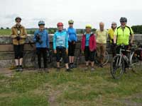 Disappointingly, a light rain followed us for most of the morning so the planned picnic on the banks of the Tweed at Kelso was swapped for lunch at the Mayfield Garden Centre, though those at the head of the queue chose to find us tables outside! The mobile phone experts amongst us managed to order online and be served before the rest of us had even had our choices noted. The drizzle stopped with the arrival of food and the day brightened.
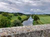 After Kelso we left the official route to avoid the A699, heading south on the B6352 before turning onto a back road to Roxburgh. The footbridge just before the village had been removed since last year’s ride with a diversion leading over the former rail bridge. This offered a wide alternative with fantastic views in all directions.
Four split off shortly afterwards to complete a Three Abbeys route, omitting Jedburgh and stopping in Ancrum for a snack in the bus shelter!
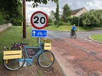 The rest of us encountered another diversion indicating closure of the Kalemouth Bridge. This meant either a detour to pick up the official Four Abbeys route again or opting for an alternative. Time being against us we chose to continue on the road to Nisbet and then turn off to Jedburgh cycling via Crailing. However, we later discovered bikes can in fact still get across.
A little later Barbara, ahead with the Three Abbeys group, reappeared at a T-junction, shooting passed hunting for her ever-escaping milometer. She was hotly followed by a lycra clad biker who’d picked it up. As he was handing it over to us the owner reappeared, happily reclaiming the device. The Jedburgh quintet went on to enjoy tea and cake in the sunshine overlooking the square.
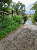 Black clouds roamed around as we headed on but seemed to drift and avoid us, obviously recognising they’d met us in the morning. We took the short cut from Belses, which was quite rough, but the ford was picturesque.
We timed it well for the train, arriving shortly before one left. Getting on in two’s for the separate bike compartments Sandie & I took our seats. We hadn’t spotted another train coming in but luckily saw the others changing over thereby avoiding a half hour wait on what would be the second train. Picnic lunches became a welcome dinner during the ride so time just to relax on homecoming.
Anna
Photos: John, Tiana, Anna
Three Parks day ride
Saturday 12th June 2021
This ride was notable for the long interval between when it was proposed and when it was carried out. I originally proposed it on 30 November 2019, but it did not take place until 12 June 2021. The main reason for suggesting it was that, during 2019, Scotrail had introduced through trains from Edinburgh to Glasgow Queen Street High Level by way of Falkirk Grahamston and Cumbernauld, every half-hour, Mon to Sat. This made it feasible to organise a dayride which began by taking a train from Edinburgh to Cumbernauld. I envisaged that the route for the cycle ride would be 45 miles from Cumbernauld Station, due east to Haymarket, with the wind behind us, and with a high proportion of the route either on minor roads with almost no traffic, or on well-surfaced off-road cycle paths.
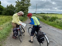 A second reason for starting from Cumbernauld station was that it was only 2 miles from the excellent café at Palacerigg Country Park, which opened at 10am, and could provide ‘Second Breakfast’. Later in the ride, we could use similar facilities at or near Beecraigs and Almondell Country Parks, for lunch and tea. Hence the name ‘Three Parks Ride’.
The ride was scheduled for Sat 25 April in the Mellow Velo programme circulated early in 2020. Sadly, coronavirus arrived in the UK before that date, and we had to obey the various restrictions applicable on 25 April. Although cycling near home was encouraged, trains were only to be used for essential journeys. All three Parks were still open to cyclists, but all buildings in the Parks were closed. We could manage without their cafes, but I doubted if we could manage without their toilets! Reluctantly we had to mark the Ride as postponed, though hoping that it might still take place later in 2020 if the restrictions were relaxed sufficiently.
 But this was not to be. As if the coronavirus was not a sufficient disaster, on 12 Aug 2020 the area experienced the 200-year-rainstorm! The Union Canal burst its banks near Polmont, and the resulting flood severed the main railway between Edinburgh and Glasgow, which also carries the trains for Cumbernauld. Trains were replaced by buses for many months. Moreover, the toilets, café, and visitor centre in Palacerigg Country Park were all still closed at that time. But the good news was that at Beecraigs, the public toilets, the visitor centre, and the Hideaway Café were open. Therefore, the Three Parks Ride now became the Two Parks Ride: no trains were involved, just a simple circuit of 41 miles from Edinburgh, passing through Beecraigs Country Park, and over Almondell Country Park. This took place in Sept 2020, and the report appears in the Mellow Velo website.
 The programme for Mellow Velo rides which appeared early in 2021 again included ‘Three Parks Dayride’, but the date was given as ‘tbc’ (to be confirmed). The reason for the lack of a date was that I was waiting for the Café at Palacerigg Country Park to re-open, so that we could get our ‘second breakfast’ there. Eventually I discovered that it is not going to re-open, and the same applied to the ‘19th hole’ at the nearby Palacerigg Country Park Golf Club. I felt it was important for those who had spent an hour or two travelling from their home near Edinburgh to have a ’second breakfast’. Otherwise, someone would get ‘hunger knock’ during the 2 ½ hour ride to our lunch stop. Eventually I discovered a solution: the Footgolf Centre, which is half way between Cumbernauld station and Palacerigg Country Park, has a café which was functioning, and I reserved space for us, from 10 to 11am.
There were 7 cyclists on the ride, including one who we were welcoming for the first time. The weather was ideal for cycling, and we even had the west wind which I had forecast in my original proposal, blowing at 16mph!
.jpg) From the Footgolf Centre we headed up to Palacerigg Country Park, passed the depressing dead café, visiting centre and toilets, and followed a gravel track for 1.5 miles to the far side of the Park. Here we turned SE, uphill, on a tarred road, and paused briefly at Fannyside Moss. This is a textbook example of a ‘raised bog’ i.e. it has not just accumulated in a hollow, but has grown upwards into a dome shape. I circulated a newspaper cutting which said it has been growing for 9000 years, and is up to 9 metres thick. Photo taken from Guardian article.
From the Footgolf Centre we headed up to Palacerigg Country Park, passed the depressing dead café, visiting centre and toilets, and followed a gravel track for 1.5 miles to the far side of the Park. Here we turned SE, uphill, on a tarred road, and paused briefly at Fannyside Moss. This is a textbook example of a ‘raised bog’ i.e. it has not just accumulated in a hollow, but has grown upwards into a dome shape. I circulated a newspaper cutting which said it has been growing for 9000 years, and is up to 9 metres thick. Photo taken from Guardian article.
After passing Fannyside Loch, we turned left (no sign). At the next corner a sign said Private, but we continued straight ahead on a road which has a good quality gravel surface for the 0.6 miles to Grangeneuk farm, where the tarmac starts again. Here I waved to one of the two shepherdesses whom I had met during my reconnaissance. They had made clear that they were happy for cyclists to use the road, but flocks of sheep had priority, so I chatted for about 10 mins with one shepherdess, while the other drove the flock from one field along the road to another field.
 We met almost no traffic on the delightful road between here and Dyke farm, then continued past Lower Boxton to join B8022 and B825. To avoid descending into the Avon valley and having to climb up again, we bypassed Avonbridge village, using a tarred minor road (no sign), then followed B8028 to the edge of Westfield.
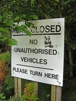 To avoid crossing the A801 by an unpleasant roundabout further ahead, we turned right here (no sign). A gentle climb and descent took us to Bridgecastle, where we turned left (east). Then, where the road turns sharp right, we turned left, ignoring a ‘No through road’ sign. One then meets a series of threatening signs intended to prevent motor vehicles from becoming trapped and unable to turn around on two roads which had been abandoned when the A801 was built. Ignoring these signs, we finally reached the A801 where railings and a sign saying ‘Cyclists cross with care’ were reassuring. Although traffic on the A801 travels at 60mph, visibility is perfect in both directions.
Here we began the gradual ascent to Beecraigs Country Park. This skirts the village of Torphichen, and passes an unusually-shaped building which is in fact a recently-built ‘self-sufficient house’. At the top (Cathlaw) we turned left and took the third entrance to Beecraigs Country Park. This took us onto a cyclable path which comes out at Balvormie picnic area.
 We had been looking forward to a relaxing picnic lunch, perhaps supplemented by ice cream or drinks from the ice cream van parked nearby, but I now realised that we were running late, and might not reach the teatime café, where I had reserved tables for 1515, before it closed at 1600. So, regrettably, we had to eat our lunches as quickly as possible, and continue.
The remainder of the ride followed almost exactly the same route as the Two Parks Ride which took place in Sept 2020, and is described in the report section of the Mellow Velo website. I will not repeat the details given there, but will only mention the few differences between the two rides.
 I did not need to use an algorithm to decide between the two cafes near the Almondell Country Park. The Calderwood Café, which we used in 2020, now closed half an hour earlier, at 3pm, whereas the Almondell Café was now open an hour longer, till 4pm. As I expected we would arrive about 3:15 pm, I had booked for us to have tea and scones at that time, at the Almondell Café. In fact, we did not arrive until 3:45. The penalty was that the scones were finished, but there were still plenty of delicious cakes. Although the Almondell Café has no outdoor seating, it is spacious, and they had reserved 3 tables more than 2 metres apart, so that we could meet the Level 1 requirement that people from no more than 3 households should share a table.
My reconnaissance had revealed that the originally intended route would be closed for road works in 2 places. One was just after leaving the Almondell Café, so we had to retrace our tracks for 0.3 mile, then use an 0.6 mile section of the NCN75 which is shown on the Spokes Map as having a ‘very poor surface’.
The other closure was on the Water of Leith Walkway at Juniper Green. This meant that it was not sensible to join the Walkway at Currie, before the diversion, but better to join it just after the diversion, at the east end of Juniper Green. This meant that we did not need to climb up the tedious hill from Curriehill Station to join the A70 at Currie, but could sneak through by an almost flat route shown on the Spokes map of Edinburgh. This began by following a footpath which branches from Curriehill Road, between two high hedges (no sign). This led to a housing estate, where we followed Knowe Cres, Corslet Road, and Muir Wood Road, and reached the A70 between Currie and Juniper Green. Part of this route involved a new and exciting experience: cycling from west to east along a street which is one-way east to west for cars, but is 2-way for cycles! Google street view And for most of the way, no separate cycle lane is marked! We just followed the ‘keep left’ rule, and survived.
On the Two Parks Ride in 2020, I left the group once we had joined the Water of Leith Walkway at Currie, and cycled back home to Linlithgow, because I was reluctant to risk catching COVID by taking the train from Edinburgh to Linlithgow. By the date of the Three Parks Ride in 2021, I had received both my vaccinations, so was happy to use the train. This meant that most of the group stayed together all the way along the Walkway and almost to the end of the Union Canal tow path, where we said our goodbyes.
My thanks go to Tiana and Miranda for providing the photos, and to Tiana for acting as my Native Guide to the backstreets between the tow path and Haymarket Station.
Alastair M.
Inaugural Ride
Saturday 1st May 2021
Launched at Last!
The original plan was to cycle through the Dalmeny and Dundas Estates but there were route restrictions due to lambing, so we decided to cycle to Ormiston instead.
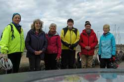 There were seven of us. Covid-19 restrictions stated a maximum group size of six, so four set off early and three later. From the Commonwealth Pool, via the Innocent Line, Queen Margaret University and Whitecraig, we were soon at Smeaton Shaw and Crossgatehall. Climbing to Cousland, the significant climb of the day, we got good views of the Pentlands. Two miles east of Cousland we stopped for lunch at Hadfest, a nature reserve managed by Scottish Wildlife Trust. There was a picnic table, laminated information sheets and an excellent notice board. We were fascinated to learn that a Goldcrest, weighing just 5.5grms, had flown there from Sweden – a distance of 1595km. – in just 40 days!
One left at this point meaning we could now travel as one group. We headed east to Ormiston where we admired the unusual war memorial. After a short climb, we were soon at Tranent where we took the off-road track towards the Monument to the Battle of Prestonpans. At the bottom of the very pleasant descent, we turned sharp left, onto Brickworks Road, staying off-road. We then turned right crossing the A1 and the railway line to arrive at the impressive Preston Tower for a short rest and snack.
We continued to Prestonpans then took the coast road to Fisherrow for coffee or ice-cream in the harbour and the essential Mellowvelo photo. We returned home via Duddingston.
Barbara
Photo: Tiana
...
Again, because of Covid-19, rides may be postponed or cancelled.

back to top
