Cycle Rides from 2017
Great cycling tours, routes, cafés and anecdotes
Loch Katrine
Saturday 28th October
 Friday was a glorious autumn day and so was Sunday. Unfortunately this ride took place on the Saturday between and the forecast of light rain throughout the day proved accurate. Amazingly, this did not put anybody off and eleven of us met in the café in the Scottish Wool Centre in Aberfoyle: AJ, Alastair, Barbara, Ian, Jan, John, Kathy, Keith, Penny, Sandie and Tiana. The party included a few new faces, which is always good news.
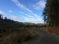
The forest track was more popular than the road over the Duke's Pass this year and seemed in much better condition than in the past. The rain had washed a few gullies across the roadway but elsewhere the surface was superior to much of the road. The autumn foliage was beautiful but would have looked even better against blue sky rather than drizzly clouds. We all arrived without mishap at the Trossachs Pier café, where the road party had just finished their second coffee of the morning while waiting. The café has been full of coach parties in the past but not on this occasion and we had no problems getting lunch.
 We faced a gusty headwind blowing frequent showers into our faces as we rode along the water board road on the north shore of Loch Katrine but it was warm and windy enough to dry us between cloudbursts. We stopped for the group photo at the viewpoint opposite Royal Cottage. Unfortunately it has a good view because it is high and open, so we were exposed to the full force of the wind and did not hang around after the cover blew off my helmet.
A few more miles brought us to the Pier Café at Stronachlachar. In the past we sat outside in the rain but nowadays we allow ourselves to go inside and consume further tea and cakes. A sharp climb took us up to the road from Inversnaid, after which it was mostly downhill with a following wind back to Aberfoyle. We didn't encounter any tour buses, which was a relief, but the surface of the road is disintegrating and was often unpleasant for those without suspension or fat tyres.
 According to my mileometer we rode 36.6 miles (for the route through the forest) and spent 3.5 hours riding. We met at 1000 and arrived back in Aberfoyle at 1700, which is a total of 7 hours. That means that we spent as long in cafés as on the road, living up to the Mellow Velo tradition! Some participants stayed in Aberfoyle for the weekend and rode through the forest on Sunday. They were rewarded with blue skies and delightful views.
Thanks as always to the drivers who offered lifts, without whom this ride could not take place. Should we try the loop in the opposite direction next year?
John
Photos AJ, Jan M and Tiana
Dawyck Gardens
Saturday 21st October
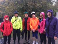 This ride was almost on the point of cancellation more than once as Storm Brian approached the UK but there was a last minute reprieve as it seemed England was to take the brunt of the bad weather.
Seven of us met as arranged at Kingsmeadow car park in Peebles. A change of plan was agreed upon – the route over the Meldons was abandoned and we took the same outward and inward route via Cademuir, Tweed Valley cycle path and foot-bridge to Lyne Station and onwards via Stobo. We stayed dry and the wind was light, so all good.
 We arrived about an hour and half later in time for a coffee and a guided walk round the garden – unfortunately the recent gales had taken down a lot of the autumn colour but there’s always plenty to see.
After lunch we set off back to Peebles. There was slightly more cycling than eating and talking on this ride but not by much margin! However we got there despite all the uncertainty. Thanks to everyone who came along and a welcome inaugural ride to Ann.
Elaine (text and photos)
Peebles Day Ride
Sunday 15th October
Participants: Sandy, Peter, Alastair
A 9am start into a fairly heavy headwind to Broughton for morning coffee (excellent cafe on the corner). The A701 to Tweedsmuir was a tussle against the wind, amid unusually heavy traffic caused by a diversion on the A702.
From the end of Talla Reservoir to the summit we were in a Scotch mist, but over the top it was a different world, clouds lifted and we sailed past Megget Water.
We had an alfresco lunch sheltering behind a ‘bothy’ at Capperscleuch, beside St Mary’s Loch. The wind then almost literally drove us down the Yarrow to the Gordon Arms - 7 miles in about 15 mins.
At Traquair we had the choice of continuing to Innerleithen and take the old rail path, or to stay with the B road to Cardrona and join the rail path there. We chose the road option, as it has more shelter and is shorter. We were back in Peebles at 4pm, still daylight.
Peter
Loop from Carlisle to Cockermouth
Saturday 2nd - Sunday 3rd September
Anna, Tiana, Alastair, Euan and Eibhlin
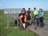 This varied ride started from Carlisle following the Solway Coast as far as Maryport, though not always on the coastal road. Then up over the hills to Cockermouth for the night. The second day began with a hilly morning yielding fantastic views looking down on to Bassenthwaite Lake, finishing with an easy afternoon back into Carlisle.
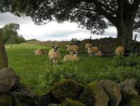
From Carlisle, the statue of Edward I at Burgh by Sands provided a first stop. Then along the Channel of the River Eden in sunshine. Cows were grazing on the extensive saltmarsh and frequent road signs warned us that the road can flood with a high tide. A heron was a welcome sighting.
From Bowness on Solway we dropped down to Whitrigg to save a few miles and avoid the less interesting section of coastline. From Abbeytown we opted for the quieter route with a large ‘road closed’ sign but the bikes got through and we were soon at our lunch stop at Seaville where sandwiches were served with fruit salad and soup came in seemingly bottomless bowls.
 We cut across to rejoin Route 72 just before Beckfoot, opting to ride the narrow lanes and wind round the lake at Tarns Dub before rejoining the coast just north of Allonby. I suffered a puncture but by the time the spare tube was out the bike was upside down, the wheel off and Euan ready with his Marigolds! And it proved to be a real toughie. I so appreciated all the teamwork.
From Allonby the cycle path takes you off the main road so we could enjoy the views across to Dumfries & Galloway as we pedalled without worrying about traffic. Our stop at the golf club was ideal – the chef was off so we were about the only customers - and sat with large pieces of cake outside soaking up sunshine and the view.
 The seawall was a fun way to arrive in Maryport but the hills that followed less so although they did take us through some interesting villages to Cockermouth. Here the tall, narrow Riverside B&B was a treasure trove of just about everything with two sharing a studio flat just off the internal garage, two in the attic three floors up, and one in between.
The second day took us up into the hills around Bassenthwaite Lake with memorable views down over the water. Then down into Caldbeck for a well earned lunch at the old mill.
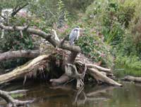 The hills flattened out in the afternoon but before the last Euan unfortunately took a nasty tumble which was as much a shock for those behind as it was for him. A helmet and good jacket saved the day but left us all feeling a little subdued. The rest of the afternoon took us along narrow lanes before picking up a path along the River Caldew into Dalston and then continuing to follow the river along a flat cycle path that took us almost all the way back to Carlisle station.
Another heron, perched very close to the water’s edge, made a fitting end to the trip.
Anna
Photos: Anna and Tiana
Carlisle to Tweedbank
Saturday 5th - Sinday 6th August
To have one bridge taken out of service on your weekend is unfortunate but to have two….
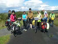 We were progressing nicely having navigated through a maze of Carlisle streets to Rickerby bridge only to find it closed – properly closed. Notice was apparently on an A5 sheet of paper at the end of school lane, far too small to read while moving along. We had to skid our way along a muddy path back to Eden bridge (It would have been quicker to use the roads…) and then use a narrow but metalled path along the north side. At the car park for Rickerby memorial park there was a very large yellow sign saying bridge closed. One rule for cars that can never use the bridge and another for cyclists who do use it. No surprise there then….
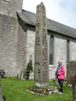 We were eight – a full house for the weekend; Barbara, Jenny, Anna, John D, Keith and I who started from Carlisle met Lynn and John B at the café at Walton about 10miles to the North east. It was to be our only stop of the day so some of us took a carry out for later. The stop marked the end of the sunshine and the start of showers.
After Walton the road starts to climb and the traffic decreases enabling us to enjoy the views. After another 10 miles we reach Bewcastle with its ancient cross shaft in the churchyard and a small museum giving some of the history of the area. Behind the church is the ruin of the castle itself. After the educational break we continued riding the tops of this high farming area dropping sharply down to a river called the Black Lyne – indeed containing some very brown water – where we attempted to play pooh sticks and failed for a rather obvious reason…
 The landscape changes to forest until Kershope bridge where we cross in Scotland. We were surprised that the border ran this far north. Up hill again before a lovely run down into Newcastleton.
We stayed at Woodbine Cottage. We were lucky to get it just for the one night; the owner is obviously looking for longer stays. It is beautifully appointed and when you have the full eightsome wonderfully cheap! We bought most of the decent veg from the Spar shop and created a large main dish which we followed by summer pudding carried in by me.
 Next morning John D decided that he would choose his own route back to Carlisle while the rest of us set off chased by midges in the opposite direction. We paused at Saughtree Station to view the train on its 400m stretch of line before slogging up the hill. It’s a great run down towards Bonchester Bridge slowed somewhat by the loose chippings on a short stretch.
We had lunch there at the Horse and Hounds Hotel. The service was a tad slow but the food good and we felt disinclined to leave for the rain had now set in. It stayed that way for the rest of the ride.
We headed on the back roads to Denholm then on the B roads to Hassendean and Lilliesleaf and were intending to go through Midlem when we met the second bridge closure – at Shawburn.
After a quick look at the map in the rain we decided to go to Melrose on the B road and take the cycle path to Tweedbank. Easy to navigate. The group split into two so seven of us were not attempting to get on the same train – but as it happened the seven of us did! Fortunately Borders Rail had put on longer trains for Festival – whew!
In all a great route and no-one was sorry to miss the hill at Midlem.
Tiana
Highland Perthshire
Saturday 8th - Sunday 9th July
 Jan M, Jan U, Anna, Tiana, Alec, Alastair, Euan and Barbara. Most of us arrived by train (2 the previous evening).
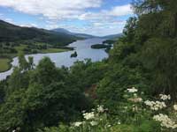
Saturday. Meeting at the hostel, we were soon on the road for coffee and photos at Queen’s View. We could glimpse Glencoe at the far end of the Loch Tummel. We then headed for a leisurely and delicious lunch at Riverbank Café in Kinloch Rannoch. (20 miles.) The good weather continued all day. We climbed to Braes of Foss admiring the great Schiehallion (and a squirrel spotted by Euan).
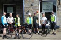 Alec alerted us to the work of Rev. Nevil Maskelyne who, in 1774, calculated the mass of the earth using Schiehallion.* Consistent with Mellowvelo tradition we stopped at the plaque to reflect on this achievement.
We had climbed to 388m from Kinloch Rannoch so were delighted to turn east and spin along the south side of Loch Tummel with the wind behind us. Near Cluny Dam the road gets steeper but by then we were triumphant and well prepared for the climb planned for the next day.
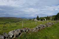 Arriving in Pitlochry, we made the usual visit to the Co-op to buy all we needed for the evening meal and arrived at the hostel at 7.30 p.m. It seemed to me that the hostel had been refurbished. Under Tiana’s guidance, we cooked the meal together enjoying it in the dining room in the evening sunshine.
Total ride: 42 miles.
Sunday. Leaving at 9 a.m. we took a steep left from the hostel going via Moulin to Kirkmichael (12 miles). It was tough going but the views were glorious and the sun was shining. We were early for the essential coffee and cakes in the village shop. After a small route hiccup we continued on the A924 to Blairgowrie for lunch. This had been booked at the Cateran Café on the High Street. We received a good welcome and were well satisfied with the menu.
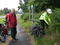 As we left the rain began and lasted on and off for the afternoon. The route to Dunkeld needed some care. We left Blairgowrie on the A93 for a short while, then right onto B947 and right again for Craigie.(Don’t miss this.) Via Clunie we headed west for Loch of the Lowes. I had planned to go into Dunkeld but we decided to take the yellow road to stay east of A9 as far as Ballinluig. We had tea/coffee and a cake and continued to Pitlochry via Logierait then NCR7 – coping with yet more hills to take the train home.
Total ride: 51 miles.
The weekend reminded us of the beauty of Perthshire. I can never get too much of those trees, hills and big skies. The participants and the usual MV camaraderie made the weekend a delight.
Barbara
Photos Barbara, Jan U and Tiana
*The mass of the Earth was first determined in 1774 by the then Astronomer Royal Nevil Maskelyne who used the mountain Schiehallion in Perthshire as a counterweight to the Earth in a series of astronomical observations. This is well worth a google search.
A week in the Outer Hebrides
Sunday June 18 – Sunday June 25
Jan, John and Barbara spent a relaxed week in the Outer Hebrides, cycling northward from Castlebay on Barra to Stornoway on Lewis. Much of our ride lay along the recently named Hebridean Way (Sustrans route 780) but we did not follow it slavishly and did not try to reach the northern tip of Lewis.
Sunday: Home to Castlebay.
 We joined up at Glasgow Queen Street for the long journey out: 3 hours on the train and 5 on the ferry from Oban to Castlebay. The weather was drizzly for most of the way but we saw the Ardnamurchan lighthouse through a clear patch. A swell developed after we left the shelter of Mull but was not uncomfortable. The string of islands to the south of Barra was spectacular and the sun flashed through the clouds over South Uist.
The ferry arrived in Castlebay at 1815, manoevering carefully around the castle in the bay. A short ride took us to the busy Dunard hostel. It had no shed for bicycles so we had to leave them out in the rain overnight. The local Co-op was still open and we stocked up for breakfast.
Monday: Castlebay to Howmore.
 It rained overnight but eased by 0930 when we left. We planned to visit the official start of the Hebridean Way on Vatersay but were short of time for the ferry so we took a photo at the first bus shelter after the causeway and turned around. The large beach to the north of the ferry terminal is used as Barra Airport and we hoped to see a plane land but were thwarted. The weather improved during the smooth crossing and both the sea and sky were glorious blue colours when we reached Eriskay. We had coffee at the well-stocked village shop and bought a picnic lunch.
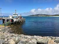 After lunch we followed the Hebridean Way along South Uist, taking diversions off the main road through townships of scattered houses amid the machair. In Dalabrog we reloaded with groceries at the well-stocked Co-op before setting off northward again. Just after Flora Macdonald’s birthplace we took afternoon tea at the Kildonan Centre, which had an interesting museum of local life. We tried part of the Machair Way but it was a bit rough for loaded touring bicycles so we stuck to tarmac for the rest of the ride to the hostel at Howmore.
 This was our first experience of the Gatliff Trust. We got the last three beds, which was lucky because they cannot be booked. Sheet sleeping bags are still required at these hostels. The dorms were in a thatched building with the common room and kitchen next door. Most guests were staying for some time, mostly fishing or bird-watching, and cooked elaborate meals in the well-furnished kitchen. After dinner we went for a walk in a chilly breeze to watch the sunset over the beach, which gave spectacular views.
Tuesday: Howmore to Berneray.
Our departure was serenaded by a fiddle player, who was using the capacious bike shed to practise. There was no alternative to the main road until after the causeway to Benbecula, which had signs for “Otters Crossing”. We turned onto the road around the western coast and rode to Nunton, where an art gallery and café occupied a former farm steading. They sold beautiful knitwear but we could not find an excuse for buying any. A few more miles brought us to the next causeway, whose crossing was enlivened by a sheep trotting along the top of the narrow wall. We followed the western road around North Uist and bought some mackerel for dinner at the Hebridean Smokehouse. Lunch was shortly afterwards in the community centre at Cladach Chirceboist.
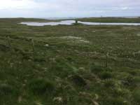 Visibility was good and we could see St Kilda in the distance. We kept stopping for photos because the view got better every time! The day’s Co-op grocery stop was in Solas but it did not have a café so we sat on a pile of pallets with a view to the hills of South Harris. After a few more miles we turned toward the causeway and crossed to Berneray, which was glorious in the afternoon sunshine.
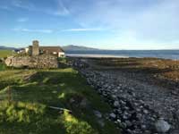 The Gatliff hostel comprises a pair of thatched stone buildings, almost at the end of the road. It was a lovely site and less busy than the previous night, about half full. One building housed the large common room and a small dorm, with the other dorms and bathrooms in a second thatched building. A ruin next door could provide future expansion! It had no bike shed, which was the only downside. Barbara and John went for a walk along the beach including a (brief) paddle. There was no bicycle shed so we propped our steeds against a sheltered wall and hoped that the rain forecast for the night would not be too heavy.
Wednesday: Berneray to Tarbet.
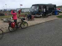
John’s proposal to catch the ferry at 0715 did not prove popular so we aimed for the 1025 sailing instead. This gave time to explore a little more of the island. The crossing of the Sound of Harris was fascinating. In several places the ferry had to slow and steer intricately between buoys and islets because the water is so shallow. The café by the pier in Leverburgh was closed so we patronised the Butty Bus instead. This is a single-decker unlike the bus at the Honey Farm but was able to provide gluten-free batter for Barbara’s fish and chips. That kept her going up the hills to come.
It was nearly 1300 before we finally set off to ride around the east coast of Harris. This started with a stiff climb toward Rodel, where we stopped at St Clement’s Church to inspect the tombs of knights in black gneiss. After that we embarked on the “Golden Road”, an attractive single-track road with little traffic. Very little of it was flat but the hills were short and not ridiculously steep. The terrain was mostly rocky and bleak, relieved by colourful villages at the heads of the sea lochs.
 We stopped for tea at the Skoon Art Café in the curiously named village of Geocrab. The paintings captured the colours of sea and sky beautifully but were far too large for a pannier! (Nor were they cheap.) We continued on our way and had to get out of the way of a school bus, which was nearly as wide as the road. The second major climb of the day took us up to the A road, after which it was mostly downhill into Tarbert. This is no more than a village, a much smaller place than we had expected. I had planned to continue to the Gatliff hostel at Rhenigidale but we were too late for that so we stayed at the Backpackers Stop in Tarbert instead. The warden was chatty and amused us while she busied herself about the place. The shops and café were closed so we ate at a hotel for a change. One waiter was brusque and the other dropped one of our bottles of beer so they got low marks for service.
Thursday: Tarbet to Kershader.
The hostel provided a “basic” breakfast, which included eggs from the warden’s croft. We looked around the Harris Tweed shop before leaving. Some items were lovely but again impractical (although you can get tweed bicycle luggage).
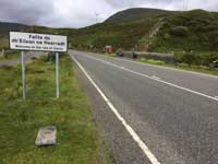 We had no choice for the route and left Tarbert on the A859. The most severe climb of the tour went over the shoulder of An Cliseam, reaching about 600 feet. Fortunately the gradient eased after the initial incline but the cloudbase was barely above the pass so we could not see the peaks. We passed the turning to Rhenigidale, which looked hard work. A thrilling descent took us over a burn and into Lewis, with easier terrain.
No refreshments were available until we reached the Loch Erisort Inn. Jan recalled the decor as retro 1970s, which proved correct. We ordered coffee and ate our picnic lunch outside despite a gentle drizzle in true MV style. A few more miles led to our accommodation at Ravenspoint in Kershader. This is a community centre with shop, café and hostel so we started by testing their tea and cakes.
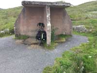 Jan and Barbara fancied a restful afternoon so John went for a ride by myself, following the Ring of Pairc recommended by the centre. The terrain was much like the Golden Road yesterday. The route went past our first Lewis “shelter”, a solid concrete structure of four crossed walls and a roof. The weather soon showed why such robust construction is needed! It poured with rain and the wind moaned around the building all night.
Friday: Kershader to Stornoway.
 We waited for a shower to pass before we departed. It was still windy, though, and the headwind made hard work of the first few miles before we changed direction and were blown along instead. The community centre at Baile Ailein advertised a café so we went in. It turned out that the café was not yet open for the season but the staff in the Kinloch Historical Society provided us with coffee, biscuits and chocolates! The museum had many fairly recent exhibits, dating from the wars up to the closure of the school only a few years ago.
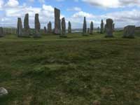 We pedalled on to the service area at Liurbost. Its café was another throwback to the past, with such dishes as corned beef hash (in a ciabatta to make it more modern). The plan for the afternoon was to turn west toward the standing stones at Callanish but this was almost straight into the wind. Barbara and Jan didn’t fancy the slog so they continued into Stornoway and did some sightseeing. John rode on to Callanish at about half his normal speed. The stones form a small ring at the centre of a cross, not the usual circle. The wind was so strong that it was difficult to take photographs! He was blown back to Stornoway along the Pentland Road in top gear, even up the (gentle) hills.
We stayed in the Heb hostel, which was full. The men’s dorm must have been the master bedroom before the house became a hostel and had an extraordinary en-suite bathroom with a free-standing bath and bidet; you don’t often see that in a hostel! The common room was gloomy so we sat around the kitchen instead, which was warmed by a Rayburn.
Saturday: Day out from Stornoway.
The wind was still blowing so Jan and Barbara decided to take the bus to Callanish. This required careful study of the timetables to avoid waiting for hours between buses.
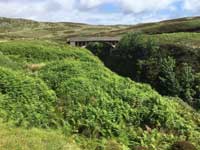
John decided to ride up the east coast to the ‘Bridge to Nowhere’ instead. This lies at the end of a road that was intended to run all the way up the east coast but was abandoned halfway. He was blown along by the wind, which was strong enough to blow his cap off: not a good omen for the return. A few light showers dampened the ride too. There were no cafés but the Tolsta Community Shop provided coffee and wifi. The sun came out by the time that he reached the Bridge, which lies just beyond the glorious sandy bay of Traigh Gheiraha.
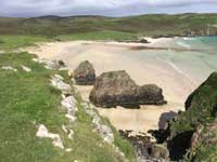 The ride back was not as much fun. At first John faced a headwind but it turned into a crosswind and became so strong and gusty that he had to walk through the more exposed stretches to avoid being blown off. We all got back to the hostel mid-afternoon and visited the Lewis Loom Centre, a quixotic tweed shop that sold a mixture of finished clothing, tweed knick-knacks and offcuts of cloth. The rain came on and we had to dash to our celebration dinner at the An Lanntair arts centre, looking out over the bay.
Sunday: Stornoway to Home.
The hostel was much quieter; not many people arrive on Saturdays because so few facilities operate on Sundays. We got up in good time for the 0800 ferry, which wasn’t too busy. It was a new vessel, MV Loch Seaforth, and quite different from the older ferries: quieter, decorated less like a ship and with fewer outside decks, which were hard to find. We treated ourselves to full breakfasts and watched the islands slip away to the stern. It became interesting again as we passed through the Summer Isles with views of Ben Mor Coigach and Assynt in the distance. It was a shorter crossing to Ullapool, two and a half hours.

The original plan had been to take the Durness Bike Bus from Ullapool to Inverness but it no longer runs so we had to cycle along the A835 to the nearest station at Garve instead. We waited until the ferry traffic had departed but the roads are busier now that a North Coast 500 route has been publicised. We stopped for coffee at the Lael Crafts Gallery, where we were warned about the hill up to Braemore Junction. In fact the climb was nowhere near as bad as South Harris and it was almost all downhill from there. We stopped to eat at a picnic area where the road crossed the Black Water in Strathgarve Forest. No tables could be found so we sat on the parapet of the old road bridge and ate lunch with a splendid view of the falls.
 After lunch we found the old track of the A road, which crossed the Black Water over another impressive stone bridge and led us through a lovely pine forest. It came into Garve opposite the station, which was handy. We had plenty of time so we had tea at the Garve Country Hotel, another establishment with decor from the late 1960s. We had been unable to get bike reservations for all of us on the journey home so we were a bit apprehensive but the guards on both the trains from Garve and Inverness were helpful and we had no problems. We eventually reached Edinburgh and Glasgow around 2230 after a full day travelling.
It was an excellent week. We were lucky with the weather, experiencing a tailwind most of the way and little rain during the days. John even managed to get sunburnt. It was too windy for midges. Most of the hostels were good and the unplanned stop in Tarbert turned out to be one of the best. The Gatliff hostels were in lovely buildings and had been renovated with better facilities than usually provided by the SYHA; they even had USB charging sockets, for example. As usual in hostels, fellow travellers had stories and information and advice for us – some of it memorable. Jan and Barbara covered about 220 miles, John about 280 with the extra rides.
 Jan bought the excellent new Offcomers guidebook to the Hebridean Way. It includes 1:50,000 maps, which were helpful where we needed the detail. There are so few roads that the Footprint map “Discover the Western Isles”, which covered all the islands at a scale of 1:140,000, was good enough most of the time.
We were impressed with the number of well-stocked supermarkets, usually Co-ops, along the way. Each of us brought a few emergency rations – sardines, nuts and raisins, even a ready meal – but we were pleasantly surprised at the variety of fruit and vegetables available. We found plenty of cafés too and consumed some excellent cakes. Most of the buses had large lockers and would take bicycles (for a charge) and we met people who did this. We did not try the buses ourselves but would have been tempted in bad weather!
This is the first extended tour on the current MV web site, which goes back to 2006. Let’s hope that we don’t have to wait that long again for another holiday as good as this.
John (text and photos)
Rural Aberdeenshire
Friday 19th - Sunday 21st May
 Keith, Tiana, Jan M, Sue L, Alec
Based at the Highlander Hostel for three nights, we set out to explore the local area of gently rolling farmland with plenty of quiet minor roads.
Getting a bike to Huntly is reasonably easy by train, but as usual the number per train is limited so we spread out our arrival over the day and did some cycling on the Friday from local stations.
In typical MV fashion we were very flexible. On the Saturday steady rainfall and worse forecast, saw us heading for a trip on the Keith – Dufftown preserved railway. All visited the café and some even made Dufftown town!
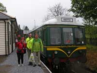 Sunday was much more active – a ride out to the coast via the pretty historic village of Fordyce. After an alfresco lunch at Portsoy’s harbour tea room (and for Keith and Tiana an hour in the interesting maritime museum) we took a more direct route back to Huntly.
On Monday we headed back towards Dyce, calling first at the Picardy stone near Insch. In Incsh we visited the Churchyard and said farewell to Jan who was catching an early train. Not far from Insch on the Inverurie road is, or more accurately was, the Archeolink park. Sadly this museum of prehistory closed some years ago but the remains are still interesting to walk around.
 Sue and Alec then took a more diect route to Inverurie while Keith and Tiana took an off-road path through Bennachie (famed for a particular granite called Macaulayite), past the Maiden Stone any bumped into Sue and Alec exiting a cafe in order to catch their train in Inverurie.
Keith and Tiana went on to visit the ancient fort at Inverurie Kirkyard and the ruins of Kinkell Church, then completing our history tooour at the Dyce symbol stones. We arrived at Dyce station minutes before the heavens opened - brillant timing and a brilliant day!
In summary the area is good for quiet B & C road cycling but hostels are very limited in number.
Keith & Tiana
Photos Tiana
Callander
Saturday 6th - Sunday 7th May
Six of us met at Falkirk High Station for a weekend's cycling to Callander and back. The route, except for the first section, was the same as my ride last year but in reverse. The weather was lovely: two days of sunshine, tempered by a strong breeze that stopped us being sweaty.
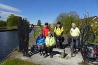 We headed along the Union Canal, then dropped down to the Forth and Clyde Canal which we followed to the Kelpies. Here we had coffee at the new visitor centre: a bit early, but there are no cafés in the seventeen miles between there and Stirling. We continued along the canal to meet NCN 76 which runs through the flat lands by the Forth with fine views of the Ochils, then a detour through Airth to visit The Pineapple, re-joining the NCN at Cowie. The section of 76 east of Cowie is very rough, so we took the B road instead. After Cowie, route 76 takes a lane that isn't marked on either the 2007 OS map or the Stirling City Cycle map of 2013, but it's all signed and tarred. One locked gate posed a problem, but we got round it.
 At Stirling, John met us for lunch after cycling from Milngavie; he would cycle back afterwards. The centre of Stirling isn't very good for cafés or access by cycle; those who brought packed lunches went to a park, but the others had to tolerate a café in the city centre.
We then went via Bridge of Allan to Kippenrait Glen. NCN 765 takes a peculiar route via busy roads and the University, so we took a shared-path route through Cornton, and in Bridge of Allan took a more easterly and higher route that avoided going along the main street and had good views over the Allan valley.
At Dunblane, tempting cycle route signs led us to the New Doune Road (A820) instead of my target, the Old Doune Road (white). Rather than risk a maze through the suburbs to find the right road - we had already briefly lost two of the group - we continued on the A road and joined the NCN on the railway path to Doune. At Doune we had excellent cakes and Bakewell tarts at the Buttercup Café, but there is no cycle parking anywhere in the town centre.
The last stretch followed the south bank of the Teith. The trees and hedges had a beautiful palette of spring colours, almost autumnal in their variety. At the end of the road a cuckoo was calling.
We stayed overnight at the community-run Callander Hostel. One of the group hadn't booked, but was lucky: he got the last available bed.
 On Sunday, we ventured south to the B822 which we followed all the way to Lennoxtown. A stiff climb through Kippen was rewarded by a superb view of the peaks of the southern Highlands. After coffee at the Courtyard Café near Fintry we tackled the Crow Road over the Campsie Fells, two miles mostly at 1 in 16 and another mile of gentler gradients: most of us managed to pedal to the top, and the one that didn't only walked a short distance. There were a lot of other cyclists going in both directions. The verges were coloured with dandelions and late daffodils, but also with dozens of discarded cans and bottles. Half-way down the other side we stopped at a viewpoint where one can see for miles over much of Strathclyde.
We had a cheap but substantial lunch at the Café Barga in Lennoxtown. By the time we got there, about a quarter to two, they had run out of baked potatoes and most of the sandwich fillings. It closed at 2.30.
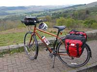 From Lennoxtown we took the tree-lined Strathkelvin Railway Path to Kirkintilloch. It was crowded with walkers and family cyclists seeking shade from the incessant sun.
The rest of the route was along canal towpaths. Last year some bits were rough and puddly, but now the whole stretch from Kirkintilloch to Falkirk is tarred, and the resurfacing of the entire length of the towpaths of both canals is due to be finished by the end of June.
At Dullatur Bog there is a long straight stretch of canal that is open and exposed. I planned the route in this direction to take advantage of the prevailing winds, but that day the wind was from the east. Such is life...
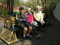 At Bonnybridge we were told that the towpath was blocked and we would have to make a diversion. We did, down to a roundabout, along a busy bit of road, then a walk up a steep path through a park back to the towpath - in sight of the point where we left it, and no sign of a blockage. As people were coming the other way without comment, we went on, and then, near a well-tended canal-side garden, met a digger coming the other way. We pulled in to let it pass. In its shovel was a young cow that had fallen into the canal and had been fished out. The rest of the herd was standing by the far canal bank, after watching their companion being rescued.
The last stage of the journey took us past the Falkirk Wheel, which was turning as we passed it, and then along the Union Canal back to Falkirk High.
All told, an excellent weekend. May the other rides this year be as good.
Alec
Photos Tiana, Barbara and Euan
Vale of Leven to Stirling
Saturday 8th April
The overall idea was to take a train direct from Edinburgh to Vale of Leven, cycle to Stirling along the north side of the Fintry and Gargunnock Hills with a west wind behind us, then take a train direct back to Edinburgh.
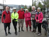 Seven folk assembled by 10:02 at Dalreoch station (west of Dumbarton). Most had come by direct trains from Edinburgh, though two had changed at Glasgow Queen Street from high to low level. The weather was ideal for cycling, dry but cloudy, about 8 to 10 degrees, and with the intended moderate wind from the south-west behind us all the way. Thanks to this wind, and the smoothness of the cycle path which follows the River Leven, it seemed like no time before we were at Balloch, where we stopped for elevenses at Corries Café. Some of us sampled their speciality: apple crumble – delicious!
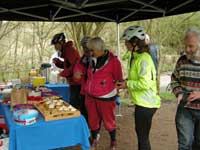
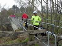 From here, after a brief glimpse of Loch Lomond, we cycled north-east, by NCR7, on quiet roads in low but not flat terrain, with the gentle Kilpatrick Hills visible on our right. At one point we crossed the Endrick Water by a ‘pipe bridge‘, where the way was so narrow that we had to dismount. A pleasant surprise was waiting for us where NCR 7 meets the West Highland Way: a stall had been set up where tea and cakes were offered in return for a donation to a local charity. We could hardly refuse, even though it was only a few miles to Doyle’s café in Balfron where we had reserved space for lunch.
 Balfron is built on a hill facing south, and so, when heading east from the top end of the town, we got what was probably the most impressive view of the day, looking south across the Endrick valley to the imposing northern wall of the Campsie Hills extending from Dumgoyne past Earl’s Seat to the Corrie of Balglass. We headed ENE on a minor road, not passing through any villages, crossing B822 near Craigend Farm, and continuing as a gated and sometimes unfenced and potholed road along the foot of the precipitous northern slopes of the Fintry and Gargunnock Hills.
The highest point reached is only 522 feet, but when we looked at the escarpment above us, we felt we were really in the hills.
 There followed a long unbroken descent towards Gargunnock, but the problem of this run was how to get to that village without being diverted onto the busy A811. The solution was to use 1.2 km of the ‘Old Military Road’ which is not tarred, to Old Leckie, and then another 0.4 km of gravel track, to reach a tarred road into Gargunnock. Here they were expecting us for tea at the Inn. My reconnaissance had concluded that their scones are good but too dainty for cyclists, who should specify a large scone or two dainty scones!
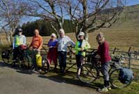
It seemed that the only way to Stirling from here involved cycling on the A811 for 1.3 miles, but forewarned is forearmed! We were equipped with high vis clothing, various flashing lights, and used a cycling formation which allowed vehicles to overtake us without too much difficulty, so we survived. With a sigh of relief, we took the minor road towards Cambusbarron. This involved a climb to a high point where we stopped for a while to admire the view over Stirling towards the Wallace Monument, before entering the built-up area and following the signposted cycling route which crosses the A9 motorway by a footbridge, and leads to the city centre and station, making a total of 38 miles from Dalreoch.
I was impressed by the way that my companions, more experienced in cycling by train than I, avoided the problem which would have arisen if all 7 of us wished to take the same train which might have only 2 cycle spaces. One had volunteered to forego her dainty scones and go on ahead to get an earlier train. Two, after tea, wished to visit the gardens of Gargunnock House, before heading for Stirling and a later train. In Stirling, one decided to explore the town before taking a later train. That left only 3 candidates for the 2 cycle spaces on the first train, one of which turned out to be occupied already, but we were all allowed on!
Alastair M.
Photos Tiana and Barbara
Inaugural Ride
Saturday 18th March 2017
 Eleven folk (Alec, Anna, Barbara, Eibhlin, Ezequiel, Jan M, Peter Ha, Peter He, Sheelagh, Tiana and Yvonne) turned up at the Burgh Café in Musselburgh to go on what the weather forecast promised to be a dry ride. So, we set off in a gentle smurr to the Esk cycleway…it changed to a noticeable drizzle by the Pencaitland railway path and some were rather wet by Humbie. We were so keen to get there that we were twenty minutes early! Five of us decided to go and visit Humbie Kirk while the rest started ordering their soup.
 It was the first time that we have used the Hub for this ride. It is a small café and one queues for service at the counter, so eleven would have been a large number to cope with in one swoop. Everyone appeared enthusiastic about the food and the view – and of course the fellow company.
 It took the donning of full waterproofs to scare the rain away after lunch. The ride back took us along an undulating route through Fala, Crichton, Gorebridge, Carrington and Polton. It was more demanding than the ride out, Polton Bank providing the finishing touch! There was a greater variety of scenery too, and the challenge of fitting new roads to an old map…
There was a ‘get out’ clause at Gorebridge that two took advantage of, the rest made home without assistance.
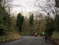 Our first ride of the year is usually nearer 35 miles so at 47+ this was a tough ‘un. I think most were glad to sink into their sofas with seconds of arriving home – two called it "the steepest ride Tiana could find"!
I shall take that as a complement and wear the badge with pride – particularly when pushing my bike up some wall of a Cumbrian fell!
Tiana
Photos: Yvonne, Peter,Tiana and Ezequiel
back to top
